I give this little trip an 8/10. This would be a great hike for kids, and for teaching about the unique ecosystem of the old-growth forest. Having gotten thoroughly soaked by the constant rain, we drove just down the road to our main objective, the Hickory Creek Trail.
Monday, May 24, 2010
Hike 18 - Hearts Content Scenic Area - 1.1 miles
Saturday, May 8, 2010
Hike 5 - Wolf Rocks Trail - 4.5 miles
It was, in many ways, a nice day for a hike. The forest has started to reemerge from its hibernation and embrace the warmer days of spring. We saw several types of wildflowers and lots of fiddlehead ferns. The moss was perhaps the most exceptional part, however; blanketing the rocky trail like a plushy carpet.
After we rejoined Wolf Rocks Trail at the end of the loop, it was only a short distance to the rocks, themselves. At the end of the trail is a large, rocky outcrop that gives a rewarding view of the valley below. We spotted a large hawk circling above and took a moment to savor the breathtaking vista. Going back was straightforward. We simply had to reverse direction and go back the way we came, this time omitting the extension of the loop trail. In a short while, we were back at our car, heading home.
This hike was not the idyllic, romantic sight-seeing venture I had hoped. For starters, the weather was cold and windy. I would have preferred to do this in warmer weather (today's high was 57 degrees!), but today was my only day off until next Monday. It was now or never. Compounding this issue, my wife and I forgot/chose not to wear warmer clothes. Moreover, this hike takes place at a high elevation (over 2000 feet), and the wind can get really serious at that height. At times, it sounded like a jet engine. Not that our entire hike was cold. At times, the sun would peek out from behind the clouds, bathing our backs in its brief, but welcome warmth.
The best part of this hike was the hamburger on the way home.
Labels:
hiking,
views,
wolf rocks trail
Monday, May 3, 2010
Horrendous hail halts Hiker. Has higher hopes henceforth.
While I would normally not be averse to hiking in any weather condition, today's rain is keeping me off the trails. It is pouring heavily outside, dampening my spirit along with the streets and houses. Yesterday was rainy, too, but only a drizzle. I was unable to hike, though, due to my wife's graduation ceremony. Seeing her receive her Master's degree was a very proud moment that I will never forget. Jackie, I love you! If you're reading this, I hope you know how very special you are to me and how much I believe in your capability to conquer any task, no matter how great (or foreboding).
Have no fear, readers. The Hiker will be back out there hitting the trails soon. The main reason I have chosen to stay indoors today is my two dogs. Due to yesterday's activities, we were gone all day. Needless to say, the puppy is restless and full of unspent energy. Red, being older, is content to sleep for 23 and 1/2 hours with no complaint. The puppy needs excercise. Lots of it. Thursday's hike tired him out for a day or so, but now he's back to his old high-energy self. Not a bad thing, to be able to rebound that quickly.
It's not that I have an aversion to the rain, nor do the dogs (Cash, at least). It is the prospect of a VERY muddy car interior that I cannot abide. I need to get myself a vehicle more suited to occasional bouts of muddiness. I do not own a truck or SUV, but merely a newer sedan with a light-colored interior. Not a good match for a muddy, wet and wiggly puppy. Hopefully, I can remedy this sooner than later. A good friend of mine, who is in the know about all matters vehicle-related, is on the lookout for a decent used truck (preferebly with closed cab) for my purchase. We'll have to wait and see.
As for other hiking opportunities this week, I think that Saturday is a good prospect. It looks as though the whole family will be going, so it should be interesting. I have a couple destinations in mind, but I'll let my wife choose. This time, I promise, it will be shorter than eight miles. Promise.
Friday, April 30, 2010
Hike 12 - Mountain Streams Trail - 8.0 miles
Yesterday, I hiked the Mountain Streams Trail, near Donegal, PA. It is located in Laurel Summit State Park, quite close to the Donegal turnpike exit. I ended up taking both dogs, as my conscience wouldn't permit me to leave Red at home. Fortunately, I also discovered a solution for his annoying, constant barking in the car. (No, not earplugs.) I used a solution of vinegar and water in a spray bottle and gave him a spray in the mouth each time he barked. It only took three sprays, and he was quiet the whole way! I was overjoyed to have found a solution to the problem that didn't hurt my dog and enabled him (and myself, especially) to enjoy our car ride together.
So, with Red in the front seat and Cash sprawled out on the back seat, we set off for Donegal. Following the author's directions to the trailhead was a fairly simple task this time. The author does confuse the reader a little bit by referring to Tunnel Road as "0.3 miles west of Hidden Valley Ski Area and directly across from an active stone quarry." Taking into consideration that most folks who drive to this area to attempt this hike will be coming from the west, it makes more sense to describe the distance from the turnpike entrance or some other landmark along Route 31. So, if you get off the turnpike at Donegal, and proceed east on Route 31, the entrance to Tunnel Road is on the left just after a large stone quarry. Drive down Tunnel road for about 1.5 miles, passing an unpaved road on the left. The author lists the name of this road as "Sky View Road" or "Sky Road," however, the sign posted identifies it as "Auckerman Rd." Start looking for a parking spot NOW. There is no lot, just a few spaces carved out on the side of the road here and there. The trailhead is on the left ahead, but you will finish your hike along Aukerman Rd. So, unless you want to walk another half-mile back to your car once you finish the hike (like I did - unghh! I parked about 1500 feet further down Tunnel Road, past the trailhead! Didn't think that one through all the way!), park somewhere between Auckerman Rd and the trailhead.
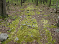
Once we hit the trail, it began with an easy walk. The first four miles of the trail were marked with red blazes, following an old jeep road. I did not see the boulders that the author depicts in this chapter. Perhaps they have since been removed. Nonetheless, we hiked this first half of our journey with ease. After a while, I took Cash off of his leash, so he could roam free. At the halfway point, I hiked with both dogs off-leash. It made it much easier to navigate the trouble ahead.
Once we reached Indian Creek, we stopped for a break and looked at the guide for the route ahead. After proceeding to the left along an old railroad grade, we crossed a footbridge and began looking for Little Run Trail on the left. Here's where it gets messy. The author writes, "There are no signs and no markers on Little Run Trail, but it's an old woods road in good condition and easy to follow." Not so. The trail was supposed to begin in 0.3 miles, so we walked and walked and walked until we came to a gate. Judging from the topography on the map, we overshot Little Run Trail by almost a half-mile. So, we turned around and kept looking for the elusive, unmarked trail. After trying several dead ends, I spotted a log blockade, and the remnants of what appeared to be a loosely strung trail heading to the southeast. So, we started to make our way through the thick brush, climbing over hundreds of fallen trees. Soon, we could hear the sound of flowing water ahead of us. I knew that if we kept walking toward the stream, we could pick up the trail, since it eventually parallels the stream. Soon enough, we made it! We all let out a cry of joy when we were once again back onto a recognizable trail.

Overall, I give this trail a 5/10. The first half was easy, but there are no remarkable sights. It was a pleasant walk in the woods, but the difficulty in finding the Little Run Trail made for some serious time lost getting oriented. GPS would have come in handy. However, if you can read a topographic map, you will be alright. Thankfully, the author puts topographic trail maps in every chapter of the book. Also, due to the many stream crossings and wet terrain, I would not recommend this hike in high-water - wait for dry weather. Again, if you are looking for views, they are not found on this hike. The babbling streams are calming, though. There also appear to be several other trails in the Laurel Summit State Park. Though they are not listed in 50 Hikes in Western Pennsylvania, I might go and explore them someday. Someday. Hike on.
Following the Little Run Trail was fairly easy, since it ran straight to the southeast. However, the stream is not straight. There are MANY stream crossings in this section. Be careful not to get your feet wet, for you still have 2-3 miles to go! At 5.8 miles, we turned right into a clearing. This turn is not marked, but it is on the right and the sun shines right through an opening in the trees. You can see the meadow from the trail. From here we followed an old access road in a wide swath until we reached a dirt road. This was Auckerman Rd. We just headed to the left and after a mile, we were back at Tunnel Rd. Here is where we learned the hard way where to park for this trail!
Wednesday, April 28, 2010
Looks more like Thursday...
Due to circumstances beyond my control, I will likely not be going hiking today. I have a work-related assignment that I need to complete before I can go out and enjoy the trails. I also have some much-neglected housework to catch up on, as well. Rest assured, however, that I will be out there hitting the trails tomorrow. I'll let you all know where I'm going to be as soon as I decide.
Monday, April 26, 2010
More plans, can't wait for the action.
On Wednesday, I'll have the day off - a perfect chance to hike. The weather has been hit-and-miss this past week, but I'm hoping for sunny skies. Haven't decided where I'll go, but most likely back to the Laurel Highlands. There are still lots of trails in that region that I need to finish. I am aiming for something in the 4-6 mile range. We'll see.
As for the short, wildflower trails I mentioned in my last post, I'll be trekking those with my wife. Maybe after she gets out of work one day this week...
UPDATE: I now have a tentative date to hike the Hickory Creek Trail (#32). My Dad and youngest brother will be going backpacking with me overnight as we tackle this 11.6 mile trail. By the end of next month, I'll be able to cross this one off my list as well.
Friday, April 23, 2010
Upcoming Hikes
I really haven't decided which hike to tackle next. More than likely, I'll do some of the shorter ones to get them out of the way. Best candidates at this point are the Wildflower Reserve in Raccoon Creek State Park and the Beechwood Nature Trails. Both are somewhat nearby and both are reported to feature wildflowers that should be at peak blooming within the next week or two. There is also a short hike in downtown Johnstown that I might attempt next week as well.
Subscribe to:
Posts (Atom)