It rained on Saturday, but there was no turning back. The trip had been planned over a month earlier, and though I exhibited a brief hesitation, it was Dad who maintained a carefree attitude, which cemented in my mind that our excursion would be unaffected by any natural obstacle, even rain.
After our short walk through Hearts Content, we shouldered our packs and began our overnight journey on the Hickory Creek Trail. Since the most recent publication of 50 Hikes in Western Pennsylvania, the trail head has been moved. I am not sure of the reason, but the trail head is no longer found at the Hearts Content Picnic Area, but in a newly constructed parking lot about 1/2 mile north. This extends the trail somewhat, adding 0.4 miles to the described trail in Tom Thwaites' book, making this hike an even 12 miles. Despite the rain, the parking lot was hosting several cars besides ours that morning, most from out-of-state. Clearly this trail is noteworthy in a larger circle than I had supposed. Having grown up a mere 30 miles away, I never knew it existed until recently.

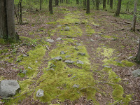
Trucking up the initial slope, we meandered past a power line clearing, the last remnant of human technology that we would see along the trail. Re-entering the woods, we walked along a hillside overlooking a misty valley to our right, giving the wilderness a dreamlike quality as the tall spruces poked their tops through the fog. In a short while, we encountered the start of the trail loop. True to my cause, I opted for the author's route and headed to the south.

So far, the longer trails I have hiked have been woven together from different marked and unmarked trails, gas lines, gravel access roads and other mismatched pieces. Not that I don't enjoy MacGuyver-ing a trail out of just about any landmark or visible pathway, but it was nice for a change to hike a remote, continuous, marked trail. The markings on the first section leading up to the loop were white rectangles, like the ones on the Appalachian Trail (a long-term goal of mine), but once the loop began, the blazes became yellow rectangles with a small bar on top, like a lower case "i." These "i"-blazes are somewhat infrequent, and can be difficult to spot at times. To avoid getting lost, I would absolutely recommend taking a decent topographic map of the area. One can be found in the book, and another good map (showing the new trail head) is featured on the Allegheny National Forest's website.

As our journey progressed deeper into the woods, the rain eased its intensity and we were able to remove our rain gear. Even though the weather was exceedingly damp, the temperature was right around 70 degrees, making the humidity quite comfortable. For another hour or so, we marched on and eventually found ourselves hiking across the south slope of a hillside. The rain picked back up, forcing us to once again don our ponchos. Soon afterwards, we realized that we had lost the trail entirely! It did not take long to re-orient ourselves, but there was a bit of backtracking involved. Much to our dismay, the trail was discovered above us, as we all groaned at the new reality of having to hike uphill. Not that it was a seriously long or steep climb; but fully-laden with gear in the pouring rain, the effort needed, both mental and physical, to ascend any incline is amplified dramatically.

Though the uphill segment was brief, the rain continued to fall. By now, my pants, boots and most regrettably, my socks, were soaked through. Despite any discomfort, we soldiered on, crossing Coon Run and a few of its tributaries. Around this area, according to the book, there are the remains of an old logging camp. Unfortunately, I was unable to identify such an area. Oh well.

After a while we were soon passing through more open territory. We crossed paths with what appeared to be a Boy Scout troop, travelling the opposite direction. Not much was spoken, save for a brief "hello," as our two fatigued groups continued on our respective ways. Soon, we were swallowed up once again in the belly of the forest.
The sunlight was waning and we knew that only a short while remained before the area would be both wet and dark, so we began to seek out a potential campsite. We passed several established campsites, but they were much too exposed for camping in the heavy rain. Onward, we crossed Jake's Run and turned uphill. After only a slight climb, we came to another crossing and then, finally, to what would become our temporary home for the next 14 hours. Amidst a grove of tall hemlocks, 100 feet (or thereabouts) to the right side of the trail, we found a great spot for our campsite. We had some significant shelter from the rain, along with plenty of space for our tents. The hike was over for the day. Time to finally put my backpacking gear to use.

First and foremost, my dad set about establishing a fire. Quite a challenge, I thought, due to the rain. All of the wood on the ground was not merely wet, but saturated with water. However, much to my relief and amazement, Dad had a sizable fire burning steadily within a few minutes. Perhaps it was magic, perhaps it was his military experience, perhaps it was the tiny fire-starting log that he had brought, or perhaps it was a little of all three; but Dad, in my mind, had just done the impossible - built a roaring fire in the pouring rain. I am so proud and thankful to have a guy like that for my dad.
Now that we had fire, that most basic element of human survival, Jacob and I quickly set up the tents and began to dry out our wet gear. Within minutes, the fire was surrounded by socks, boots and other items mounted on sticks stuck into the ground; steaming totems that reminded us of our efforts. At about that time, the rain subsided and gave way to a calm, misty twilight. With the fire ablaze and our clothes (mostly) dry, we could finally get down to business of cooking.

I pulled up a medium-sized log along the fire pit, and we sat there, the three of us, hungry and tired and still a bit damp. Dad had brought a Sterno canister, which proved to be inefficient for heating his can of soup. My backpacking stove, with its propane/isobutane flame, was found to be a better tool for the job. Ramen noodles were also on the menu, as well as my packet of tuna. We sat and ate leisurely, enjoying beef jerky, candy bars, and dried fruit as the sun finally dismissed itself and darkness of the forest enveloped our camp. Sitting around the fire, we discussed the day's hike, laughed with each other, and calculated the next days adventure. Most importantly, though, we spent some time sitting in silence, gazing into the fire, a primitive instinct from thousands of years ago. A glowing campfire is the perfect vehicle for silent reflection and contemplation of the deeper matters of the human experience. Nowhere else is one more likely to find meaningful discussion, an awakening to the spirituality of nature and, most importantly, knowledge of oneself.


The next morning, I restarted the fire, using some leftover hot coals. The rain had held off through the night and it looked as if the sky was straining to wriggle out of the damp overcoat of its cloudiness. After a mighty strong cup of coffee (didn't even need a cup!), I went down to the creek with my dad to filter some water for the upcoming hike. This was my first opportunity to use my Katadyn Hiker filter in the field. What a wonderful device! Easy to use, we filtered about 4 liters of water in just a few minutes. A true outdoor necessity.

After packing up our gear, we began hiking the remainder of our trip. By no means were we out of the woods, either literally or figuratively. We still had a good five or six miles ahead of us. After a couple of stream crossings and a close encounter with a snake, we made a sharp right and hiked back uphill. We crossed over the ridge and made our way around the hillside. The trail continued along the slope for quite some time, dipping into a valley where the trail twisted through some thick brush. After about three hours of hiking, it was time for a break. We found a shady spot and rested for a bit. The biggest question at this point had become "How much further?" After speculating that the end of the loop was, at most, a half-mile away, we turned the bend to find that it was only 50 feet from our location!
Turning left at the sign, we began the final 1.4 mile stretch down the trail back to the parking lot. The weather had become sunny and bright, lending an optimism to the day that was well-received. Sooner that I expected, we came to the trail head from where we had started the previous day.
Completing this hike was significant in several ways. I have now completed 10 of the 50 hikes listed in my book. This was my first overnight backpack of the year. Also, it was the first opportunity to use a good portion of my gear in the field. Most importantly, however, it was very special to me to share this experience with my dad and my brother. Since I live a solid two-hour drive from my folks, I get to see them less frequently than I would like. Spending any significant amount of time with them is something that rarely happens nowadays. I hope we can go backpacking together again soon.

I must take a moment to thank my parents for their influence on my project. From an early age, my parents have instilled in me an awareness of and respect for nature. They taught me to appreciate the sounds of the forest, to care for the environment and to be self-reliant. Best of all, they encouraged my loves of adventure, the outdoors, and new experiences. Thanks, Mom and Dad!
In rating this hike, I give it a 10/10. My first perfect score ever! The trail is well-defined, but integral to the landscape. Rocks and roots about, so wear your boots. There are several great views, and plenty of water sources along the trail, along with about five established campsites, so use them if you can. Also, I would recommend hiking this trail in dry weather, if possible. The canopy overhead prevents most direct sunlight, so exposure is not much of an issue. The stream crossings are fairly easy, and the trail is marked well, with the exception of a few spots. Since the Hickory Creek Area is Pennsylvania's only designated wilderness area, you have excellent chances of seeing wildlife. We saw tracks of deer and bear, heard the sounds of woodpeckers, and spotted countless chipmunks. There is even ample parking and free maps at the trail head! You really can't do much better than this. Hike on.
 Refreshed from a few days of moderate rest, I decided to hike again on Thursday. The weather could not have been better for a wooded journey as I returned, once again, to the Donegal area for my fifth hike in the Laurel Highlands. Maybe the sixth. I am beginning to lose count.

 After that first easy mile, near an unnecessary and environmentally-damaging man-made shelter, we came to our first stream crossing. The trail follows Roaring Run for about 2.3 miles, criss-crossing it a total of 28 times! This is not an exaggeration. Tom Thwaites even counsels would-be hikers to turn back if they can't handle these unavoidable obstacles. Much like in "Ghostbusters," crossing the streams is risky, but it is the only path to successful completion of the task at hand. I managed the first two crossings with ease, but the third one found me with wet toes on my right foot. It was not long before I made my first critical error, choosing a mossy rock for a foothold. Not long after, a loud "SPLORSH!" could be heard, which echoed through the valley, followed by several emphatic expletives. My entire right boot was drenched. It did not take more than six more crossings before my left one was a soggy mess, too. Even my trusty guidebook found its way into the water at one point! This part of the hike was the most miserable. Unfortunately, it was due to my own carelessness.

 Once my footwear had lost enough moisture to ensure I could hike on with as little discomfort as possible, the three of us set out up the Painter Rocks trail. The climb was refreshing, and I, at least, was glad to be done with the stream crossings for the time being. (The dogs could have frolicked in the creek all day.)
 After a short venture uphill, we wandered through some dense forest until Red picked up a scent somewhere off the trail that stirred up his Coonhound instincts. Without looking back, he tore off into the woods. I called after him, and even tried to follow him, but to no avail. I had lost my dog in the woods! Cash and I sat by the trail for a good 20 minutes, waiting for Red to return. Without any luck, I decided to continue up the trail, hoping that Red would find my scent and come back to me.

 Overall, I give this hike an 8/10. The stream is quite scenic. As long as you take your time and cross carefully, you can avoid getting your feet wet. The trail is well marked with yellow blazes (which at one time appear to have been blue) and is easy to follow. The rocks on Painter Rocks Trail are ubiquitous, so wear your hiking boots. There is a good deal of catbriers and poison ivy along the trail, so long pants or big socks are a good choice as well. Although the views from the rocky hilltop were obstructed by lots of vegetation, they would probably be much better in the late fall or winter. Lastly, you may likely encounter a good deal of hungry mosquitos, so be sure to bring bug spray.